Showing posts with label big sur. Show all posts

Garrapata's Steep Climb

No Comments »

     I was pretty surprised to learn that Garrapata State Park was one of 70 parks on California's State Parks closure list. This beautiful park and beach really offers everything- aerobic mountain climbing, pristine beaches, and moderately dense forests. In late spring, the mountain is covered in vibrant wildflowers… and sweaty hikers.
     I will admit, it wasn't until I learned this park was slated to close that I rushed to visit it. My loss.
     We parked off of Highway 1 in a turnout near a tin barn. Then, we laced our laces real tight. Initially, the hike began in a pretty flat meadow. At one point, the trail split and we mistakingly missed Rocky Ridge Trail. Despite our error, I enjoyed the lush, cool forest… as well as the gentle climbing. We turned around and realized the steep ridge we missed was the way to our peak. To be honest, I don't remember much of the ascent because I blocked it from my memory. At one point, we noticed that someone carved "I'm tired" in the dirt. But at 1,997 feet, I realized it was all worth it. We nestled on a rock and took it all in. The view was impeccable: views of the rocky Big Sur cliffs, lush forests, and mountain ranges. Do it.
     We hiked the Rocky Ridge and Soberanes Canyon loop for a total of 6 miles.
     The park also has 2 miles of beach walking. In late June 2012, The Monterey Peninsula Regional Park District and the Big Sur Land Trust agreed to help with park services in order for the park to remain open. Friends of Garrapata and California Native Plant Society will help with trail maintenance. "Garrapata" means tick in Spanish… So wear long socks.


Trailhead. 


The tin barn can be seen from Highway 1.

The trail takes you through a lush forest.

Up, up, up we go....


We even saw a deer on the way down!

The end! Whew!

Information:
Directions: From Rio Road in Carmel, drive 6.7 miles south and 18 miles north of Big Sur.
No fees.
Despite the prevalence of dogs on trails, dogs are not allowed on the trails. Leased dogs are welcome on the beach.


Beach Trail, Andrew Molera State Park

No Comments »

            Despite how long I've lived here, I am still pleasantly surprised to find new hidden gems in Monterey County. While this county has its share of amazing beaches, Andrew Molera's shores may take the cake.
            Last year, Jose took me on Beach Trail hike for my birthday. This hike suites me well, as it has many visual stimulations and photographic opportunities. Jose knows I tend to hike to observe nature- not so much for the exercise factor.
             Despite being November, it happened to be a beautiful, "central coast" day. We started our trek out to the beach from the parking lot and immediately encountered the river.  According to the park ranger, in winter, Big Sur River rises too high to maintain a bridge, so it is taken down. Lucky for me, we took off our shoes and crossed the river barefoot. Despite the painfully cold water and sharp rocks, it was an invigorating way to start. We walked barefoot for awhile in sand to dry our feet. The walk to the beach was quick, easy and very meadowy. 
            But the highlight was walking along the beach. Upon arrival, we noticed a few tee-pees constructed from driftwood.  About a mile south, we encountered beautiful cliffs and caves. Now, I am particularly fascinated with caves, so Jose and I spent quite some time checking out tide pools and running from the incoming tide.
            This State Park boasts more than 20 miles of mountain, meadow, and beach trails. For a more challenging hike, take the "Andrew Molera Loop," which combines Bluffs Trail, Panorama Trail and Ridge Trail for a total of 8.8 miles. And like everywhere in Big Sur, avoid ticks!
         -N
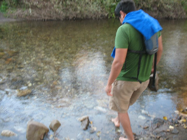
Despite being winter, Jose dips his feet in the water to cross the river.
The first half mile of Beach Trail encounters a meadow.
Beach-goers constructed a teepee from driftwood.
Glorious Cliffs!
My favorite part: Sea Caves!
Information:The park is 20 miles south of Carmel on Highway 1.
Coordinates: Latitude/Longitude: 36.2833 / -121.8333
Andrew Molera State Park:  http://parks.ca.gov/?page_id=582
Trail Map: http://hikinginbigsur.com/moleramap.html
Parking Fee.
Dogs are only allowed in developed areas.
Camp Sites available for reservation.