Archive for July 2012

The wall to the ocean. . . Border Field State Park

No Comments »


On the day before Nicole left San Diego, we decided to take a visit down to the extreme southwestern corner of California at Border Field State Park. She had visited the park earlier in her visit, but had not been able to explore to her liking (Note from Nicole: I got lost and stalked by Homeland Security). This time, we had a better map and decided we wanted to check out the border along the beach. It would definitely prove to be a bit of a surreal experience.


We arrived to a deserted dirt parking lot… the vehicle access gate was closed. As part of the State Park cutbacks, it is apparently only opened on the weekend, and we happened to go on a weekday.  No problem, we expected a nice walk anyway. We followed Monument Road directly west, a trail that would lead us to the beach. The first thing I noticed was the fence up on the hills to the south. The second thing I noticed was how loud the helicopters circling over the park were. I counted five in the air at one point.  Doesn’t really lend itself to taking in the sounds of nature, and we wondered how it affected the local wildlife. Pretty soon, the Tijuana Bull Ring comes into sight across the way. Its proximity served as a further remind to just how close we were to our neighbors to the south.


A nice trail through some bluffs eventually led us to the beach after about a mile of hiking. From there, we could see the fence about another half mile south. We were careful to stay close to the waterline, as these were nesting sites for the endangered Western Snowy Plover. On the beach, we saw a few of these small furry guys, along with some Whimbrels, and other flying critters. Unfortunately, we also witnessed a good amount of debris along the beach, like a water bottles, ballons, wrappers, and even a dead seal.


This entire time, we’d yet to encounter another person. The waves were drowning out the choppers at this point. It really was quite nice being able to walk along a beautiful beach like this one with no one in sight. The Coronado Islands were just on the horizon. And the wall was getting closer and closer. Soon, we were less than 100 feet away. We spotted one Border Patrol agent camped out in his jeep, and right around this time we noticed music coming from the south. 


Approaching the fence is a surreal experience. Our side was relatively desolate; we encountered a few people on horseback, but that was it. The Mexican side of the borderwas lively, with families playing on the beach, music booming, food being consumed, and people having a great time. It made me want to swim around the fence and join them!


It was getting late, so we decided to head back to the car. We didn’t get to see much, such as the Friendship Circle Monument or Smuggler’s Gulch (or any Mexicans trying to sneak across the border!), but what we saw was enough to warrant a visit for people curious to get a peak at this peculiar wall. Oh, and if you’re into bird watching, you’ll love it here.
            -J

One of the helicopters we saw.
Tijuana Estuary to the north
Reaching the ocean.
Tijuana in the distance.
Nicole and the fence.
Dramatic the way it goes into the ocean.
Everyone's living it up over there.
"Danger Objects Under Water"


Information:
Website: http://www.parks.ca.gov/?page_id=664
Fee: $5 on the weekends. During the week, gates are closed, but you can walk in gratis.

Two Fools in the Desert

No Comments »


Mud and wind caves.  Indian pictographs. Desert wildflowers.  Anza Borrego Desert California State Park offers approximately 1,000 square miles of caves, cliffs, and desert landscapes. It is the largest California state park and has much to offer if you don’t mind the extreme weather and have 4WD. Well, Jose and I are no desert rats and really didn’t understand the unpredictable weather or the vastness of space.   As a result, we didn’t get to see what we had originally planned. However, we did discover some hidden gems. This is a list of some lessons learned.
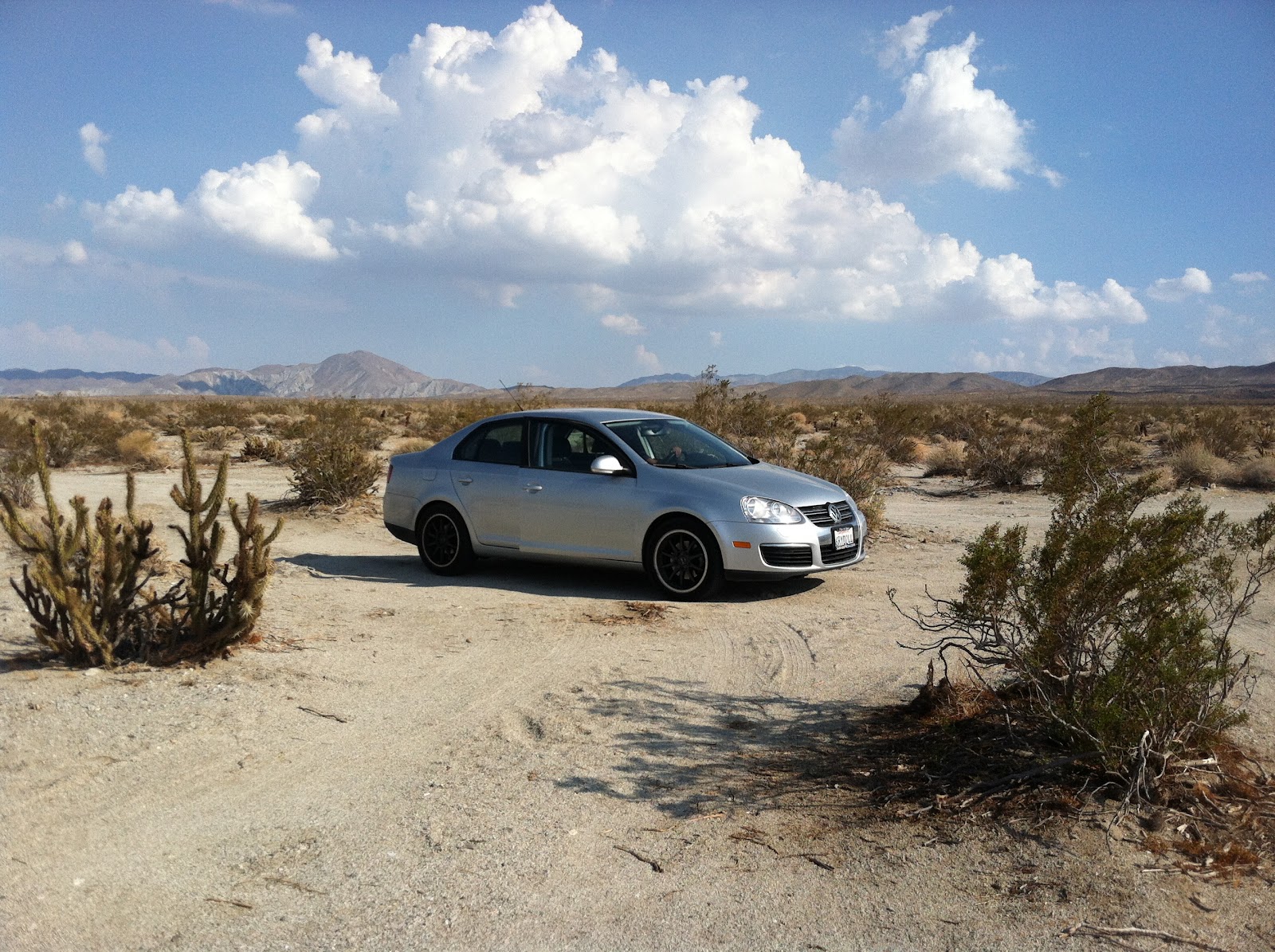
Bring the correct vehicle. Despite the fact that my silver VW Jetta looks great against the desert backdrop, my poor car was not made for desert trails. While many major roads and highways cross through Anza, some of the attractions are only accessible through “primitive roads.”
Check the weather. We were prepared for the heat. My car’s air conditioning was functioning. We purchased two gallons of water and nonperishable foods (Chip Ahoy Cookies) in case “something” happened. I even called my mother to tell her we were going and to expect to hear from us by 10 pm that night.
Apparently, deserts have thunder storms and flash flooding in summer. Upon visiting the visitor center to get directions to the mud caves, a park ranger told us that one park patron spent a few days trapped and was barely rescued earlier that day. So, we were unable to access the mud caves as well as the Indian pictographs- our primary reason for going to Anza Borrego.  Pretty devastating.
Bring a map. Anza Borrego’s signage is not very clear. Major roads are marked, however, the dirt roads in the desert are just as important but often unclear. We picked up a map at the visitor center; however, it isn’t always easy to decipher major desert roads from small turn-offs. Jose and I spent a good hour trying to get to one location driving my two-wheel drive onto dirt roads made for Jeep Wranglers.
                We did come across some amazing desert surprises. Artist Ricardo Breceda created an eerily beautiful sculpture garden which can be seen from Borrego Springs Rosd. As you head south from Borrego Springs, giant horses and dinosaurs made from scrap metal scatter the landscape.
                The Anza Borrego State Park Visitor Center is a pretty impressive facility, especially compared to other California State Parks. The air-conditioned building complements well with the backdrop. We even stopped to watch a short film, “A Year in the Desert,” and peruse the mini-museum.  
                After chatting with the park rangers in the visitor center, we received some recommendations on flood free sights. We settled on visiting an Indian archaeological site. Off of the 78 State Highway, a tiny sign led us to the dirt road called “Mine Wash.” This area is deemed “Kumeyaay Village” where California Indians made their home here seasonally. 
                Anza Borrego State Park is located within the Colorado Desert of Southern California. Bring a 4 Wheel Drive vehicle.
                -N

And we have arrived!

Me and the Giant Bird.

Infinite desert.
The visitor center. It has a bridge you can walk over. Disregard naked bike rider.

That just happened.

Jose's favorite dinosaur.
Clearing the trail of rocks.
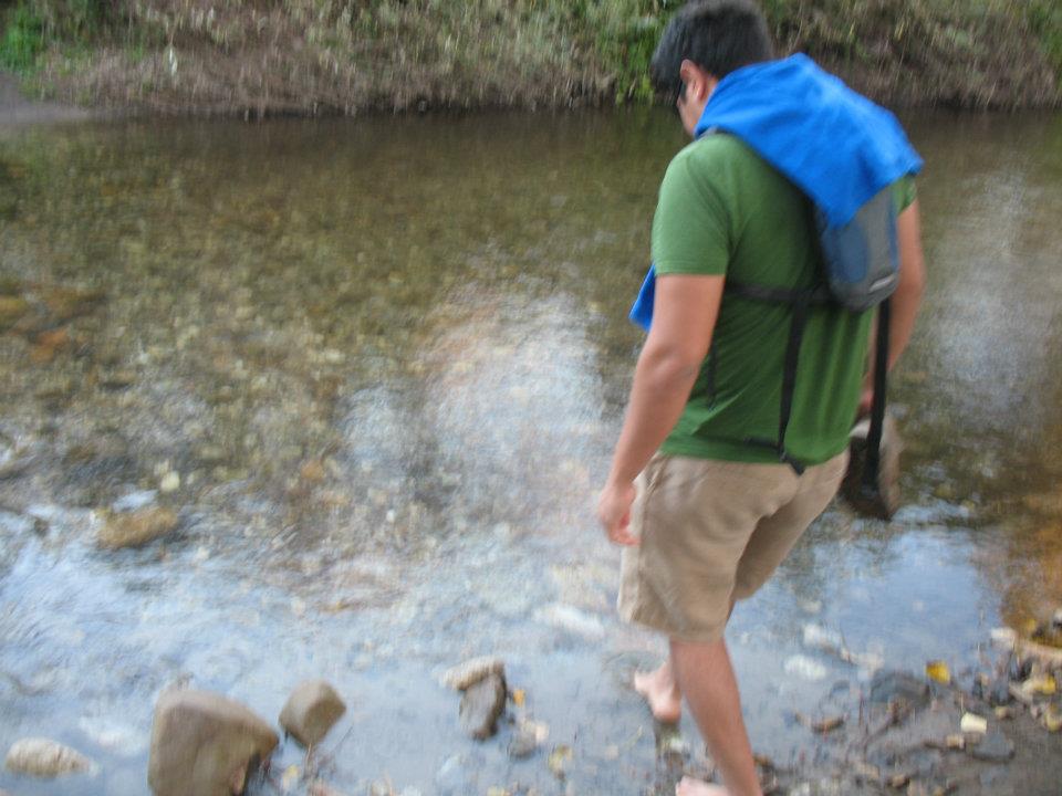
Dark and sweaty.
Jose discovers mortars.
Indian Village. 

Checking out some rocks.


She looks good... like a car ad.
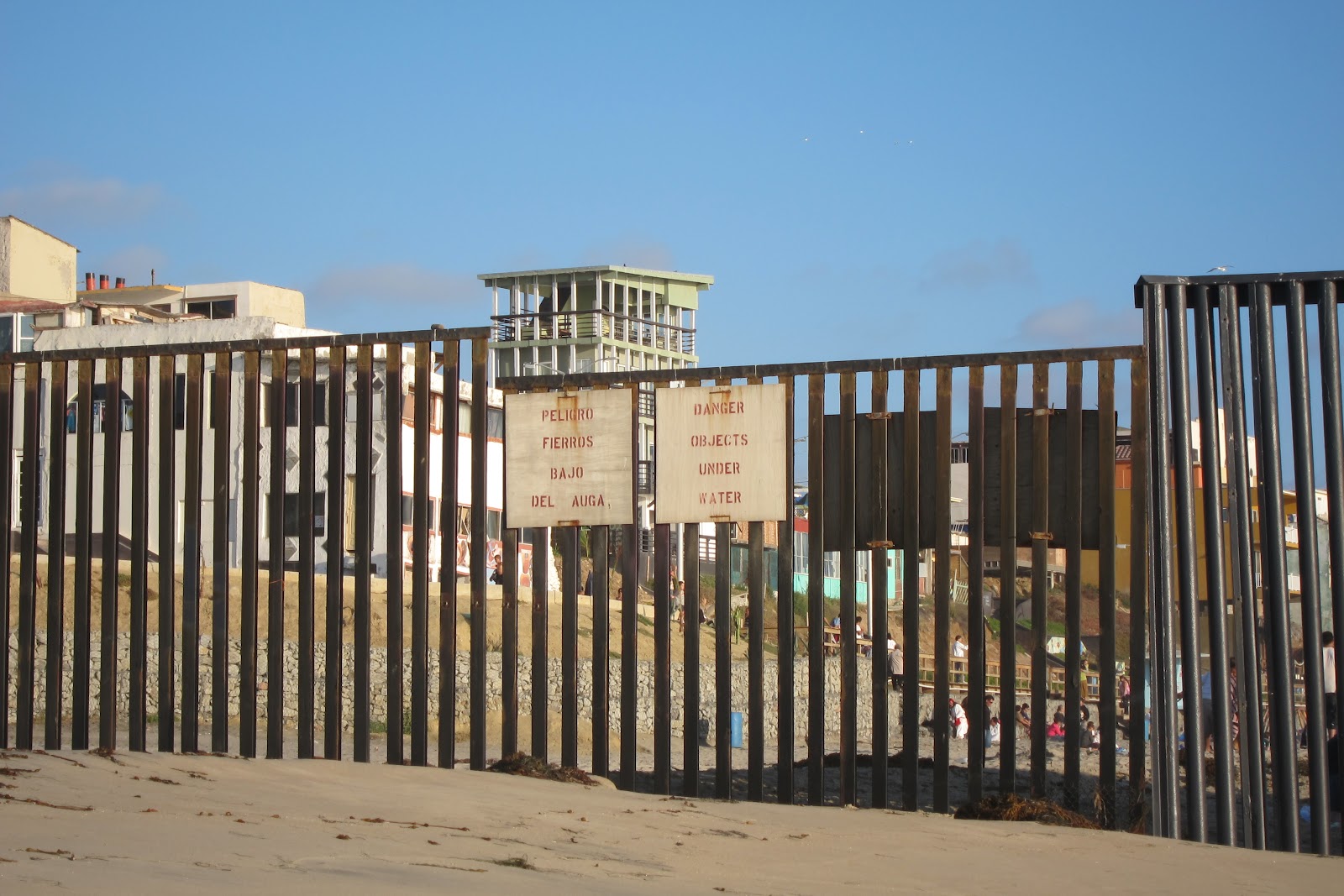
Good advice!


Information:
Anza-Borrego Desert State Park http://www.parks.ca.gov/?page_id=638
Ocotillo Wells State Vehicular Recreation Area http://ohv.parks.ca.gov/?page_id=1217
Information on Desert Sculptures http://www.galletameadows.com/
  

La Jolla Sea Caves Snorkeling Adventure

No Comments »

This past Saturday, Nicole and I slept in a little bit longer than normal in an attempt to recover from the week. We figured we’d take it easy. Maybe we might head down to La Jolla Village and walk around, possibly find a nice spot on the beach and read a book Nicole had recently purchased at the San Juan Capistrano Mission about the ghosts that haunt California’s 21 missions. It didn't quite end up that way. 

Parking in La Jolla sucks. It’s terrible. There is no way around it. I hate it. I was already in a grumpy mood to start this trek. We finally found parking in a random neighborhood a bit far from the main attractions, and made our way down. It wasn’t an especially sunny day, but it was nice enough so that everything was absolutely packed. Great. 

I am used to much more laid back settings, and the amount of people there was unnerving to me. We walked along Coast Boulevard, checking out various parks and beaches along the way, but found no place to relax. We took a small break near the famous Cave Store, which charges an entrance fee for passage through a La Jolla ocean cave. That’s when the fun really began.

Looking out into one of the well-known La Jolla Sea Caves, we realized there was a small rocky beach people were climbing in and out of in order to gain easy access to the caves. Some people were snorkeling, some were on kayaks. It seemed ideal and we quickly decided we were going to rent some snorkels and finally check out the caves. 

The Cave Store had a set of snorkel, goggles, and flippers for 20 bucks for the rest of the day. A bit steep, but it was so convenient, and we were so pumped at this idea that we went with it anyway. We climbed down the rocks to the launching spot we’d seen, and soon we were in the water. 

San Diegans who are able to experience these warmer waters are truly lucky. While the initial minute is spent warming up, after that you are good to go. Nicole and I were out on the water for a good 2-3 hours having a blast. Initially, the water was pretty calm as the tide hadn’t started to come in yet. Visibility was at a maximum, and you could instantly see bright orange Garibaldi fish everywhere. I’d never seen so many of California’s state fish in one spot, so many in fact that they became old hat during that session. Tons of other small fish were abundant, as well as other critters on the ocean bottom. I’m near sighted, and I didn’t feel like this limited my enjoyment a bit. 

We decided to snorkel through the caves, and that was an adventure in its own. The first cave we went into was rather narrow, and the water going in and out with the tide caused me to get roughed up on the rocks a bit… totally worth it. We also went into a series of other caves with a nice pool area. The last cave we hung out in has a tunnel that leads out of the Cave Store. During prohibition, it was used to smuggle alcohol, and before that to smuggle in illegal Chinese and other immigrants. It now serves as a tourist attraction and as a story to tell people going on a kayak tour of the caves, as I eavesdropped upon one. 

The La Jolla caves are something you have to experience if you’re in the area.  


La Jolla Sea Cave (photo by Nicole)


Information: 
Wiki: http://en.wikipedia.org/wiki/User:Lajollacaves 
Map: http://goo.gl/maps/Q1FF 
Directions: Walk northwest from the Cave Store and head down a wooden staircase to the cliffside towards a small viewing platform offering views of the sea caves. Head down the cliffs (CAREFULLY) towards the right side where you’ll see other people gathered. Jump in and enjoy.

Exploring Julian's Historic Past

No Comments »

        Occasionally, Jose and I will venture outside the walls of Monterey County and explore California’s other wonders. We were lucky enough to spend the summer in San Diego, which allowed us to wander a bit off the traditional touristy path. So we spent a Saturday in Julian and Anza Borrega State Park.
Julian is an adorable gold mining town, about an hour east of San Diego, preserved to its 1870’s mining prime. We spent an hour exploring the shops, restaurants, and numerous historical plaques.
        It should be noted that the most glorious aspect of this town is the pie. We stopped at Mom’s Pies on Main Street. This was perhaps the best day of Jose’s life. Seriously. On the other hand, my favorite moment was picturing Jose in an early 20thcentury jail we had found tucked away off the main strip. The jail is located on the corner of C and 4th street.
A second highlight of our trip was taking a tour of the Eagle and High Peak Gold Mine and Museum. A local in overalls, with about four teeth, handed two suckers (us) a flyer to the Gold Mine and Museum located a I loved this. This is probably because I am obsessed with small holes in the earth. The tour took about an hour and a half and our tour guide had so much knowledge on the Julian’s mining past, as well as the gold mining operation itself. The mine was rugged, dusty, and probably an accurate depiction of the mine in the 1870’s. Well worth the $10.
-N

Julian's Official Historical Marker
Pies!!!

Jail looks cozy.

Mine Museum and gift shop.

We weren't scared. At all.
Needless to say, we found no gold.


Information:
Julian Chamber of Commerce http://www.julianca.com/
Glorious Pie Shop http://www.momspiesjulian.com/


Glass Beach in Fort Bragg, CA

No Comments »

Nicole and I have been doing a lot of exploring, since I’m down in the San Diego vicinity for the summer and it’s not an area we’d normally have a lot of time to see. On the plus side, we’ve been able to visit a ton of cool places that I’m sure we’ll be posting about soon. On the other hand, I’m exhausted. This recuperation time gotten me thinking about the last year, and some of the great places I visited for the first time. One of the places that come to mind is Glass Beach in Fort Bragg, CA.

Early in the 20th century, probably even though they knew better, the residents of Fort Bragg decided hey, let’s get rid of our trash by tossing it into the ocean! Yea! Obviously, this was dumb. By 1967, the area had been closed, and there were various cleanups efforts afterwards to try to fix their mistakes. 
There is definitely a bright side to this. Decades and decades of glass being pounded by waves has created a beautiful mosaic of small, smooth, colored glass pebbles. It is nuts, and it is awesome.

I was on a road trip last December with two good friends of mine and we were interested in checking out some breweries in Northern California. Naturally, we decided to visit North Coast located in… dun, dun, dun, Fort Bragg! That night was spent visiting the brewery, and having some fun with the locals at the nearby dive. Good times were had, and we felt its effects in the morning. I had already heard of Glass Beach, and decided this might be a nice way to ease into the next day.

We had breakfast at America’s favorite breakfast spot, Denny’s (just kidding), where we were able to ask the kind waitress where we might find this “Glass Beach.” She said it was just down the road, we’d have to park along the street, walk a bit to the beach, and then walk south along the treacherous cliffs to find the part that hadn’t been ransacked when it was first opened to the public. We had street shoes on, so we were totally equipped. We paid, thanked her, and made our way down the road to the entrance to the beach. They had no idea what to expect, and I only had a slight inclination. We made good time to the beach, and noticed small glass pebbles interspersed here and there. Kind of cool, but not really. Oh well. However, the waitress has said to walk south a bit along the coast. So we climbed up and down the path and suddenly came upon the beach and were greatly rewarded. Holy cow, it was amazing! The beach was completely covered in the glass, and the tide kept running water over then, making their colors more vibrant, and the pebbles shimmering. We explored and took pictures, feeling really good about this unexpected turn.

The rest of our trip was one for the ages, and Glass Beach definitely added to it. I can’t wait to go back again and explore.

     -J

Dive bar from the night before

Denny's: Breakfast of Champions
The coast at MacKerricher State Park
Glass Beach! Glass everywhere!
This is a classic Jose picture made awesome by the glass
Nice close up of the makeup of the beach


There was so much of it

Another closeup of it

Super stoked to have visited Glass Beach
Information:
Fort Bragg's Glass Beach site http://www.fortbragg.com/explore/glass-beach/
Directions: From Hw 1, turn west on Elm Street (Denny’s is on the corner) and drive a few blocks to Glass Beach Drive (may appear as Old Haul Drive in older maps). Park at this intersection and walk down to the beach. Once there, head south for a few minutes until you see it.
No Fee.
Map: http://goo.gl/maps/Ql8n

Garrapata's Steep Climb

No Comments »

     I was pretty surprised to learn that Garrapata State Park was one of 70 parks on California's State Parks closure list. This beautiful park and beach really offers everything- aerobic mountain climbing, pristine beaches, and moderately dense forests. In late spring, the mountain is covered in vibrant wildflowers… and sweaty hikers.
     I will admit, it wasn't until I learned this park was slated to close that I rushed to visit it. My loss.
     We parked off of Highway 1 in a turnout near a tin barn. Then, we laced our laces real tight. Initially, the hike began in a pretty flat meadow. At one point, the trail split and we mistakingly missed Rocky Ridge Trail. Despite our error, I enjoyed the lush, cool forest… as well as the gentle climbing. We turned around and realized the steep ridge we missed was the way to our peak. To be honest, I don't remember much of the ascent because I blocked it from my memory. At one point, we noticed that someone carved "I'm tired" in the dirt. But at 1,997 feet, I realized it was all worth it. We nestled on a rock and took it all in. The view was impeccable: views of the rocky Big Sur cliffs, lush forests, and mountain ranges. Do it.
     We hiked the Rocky Ridge and Soberanes Canyon loop for a total of 6 miles.
     The park also has 2 miles of beach walking. In late June 2012, The Monterey Peninsula Regional Park District and the Big Sur Land Trust agreed to help with park services in order for the park to remain open. Friends of Garrapata and California Native Plant Society will help with trail maintenance. "Garrapata" means tick in Spanish… So wear long socks.


Trailhead. 


The tin barn can be seen from Highway 1.

The trail takes you through a lush forest.

Up, up, up we go....


We even saw a deer on the way down!

The end! Whew!

Information:
Directions: From Rio Road in Carmel, drive 6.7 miles south and 18 miles north of Big Sur.
No fees.
Despite the prevalence of dogs on trails, dogs are not allowed on the trails. Leased dogs are welcome on the beach.


Beach Trail, Andrew Molera State Park

No Comments »

            Despite how long I've lived here, I am still pleasantly surprised to find new hidden gems in Monterey County. While this county has its share of amazing beaches, Andrew Molera's shores may take the cake.
            Last year, Jose took me on Beach Trail hike for my birthday. This hike suites me well, as it has many visual stimulations and photographic opportunities. Jose knows I tend to hike to observe nature- not so much for the exercise factor.
             Despite being November, it happened to be a beautiful, "central coast" day. We started our trek out to the beach from the parking lot and immediately encountered the river.  According to the park ranger, in winter, Big Sur River rises too high to maintain a bridge, so it is taken down. Lucky for me, we took off our shoes and crossed the river barefoot. Despite the painfully cold water and sharp rocks, it was an invigorating way to start. We walked barefoot for awhile in sand to dry our feet. The walk to the beach was quick, easy and very meadowy. 
            But the highlight was walking along the beach. Upon arrival, we noticed a few tee-pees constructed from driftwood.  About a mile south, we encountered beautiful cliffs and caves. Now, I am particularly fascinated with caves, so Jose and I spent quite some time checking out tide pools and running from the incoming tide.
            This State Park boasts more than 20 miles of mountain, meadow, and beach trails. For a more challenging hike, take the "Andrew Molera Loop," which combines Bluffs Trail, Panorama Trail and Ridge Trail for a total of 8.8 miles. And like everywhere in Big Sur, avoid ticks!
         -N

Despite being winter, Jose dips his feet in the water to cross the river.
The first half mile of Beach Trail encounters a meadow.
Beach-goers constructed a teepee from driftwood.
Glorious Cliffs!
My favorite part: Sea Caves!
Information:The park is 20 miles south of Carmel on Highway 1.
Coordinates: Latitude/Longitude: 36.2833 / -121.8333
Andrew Molera State Park:  http://parks.ca.gov/?page_id=582
Trail Map: http://hikinginbigsur.com/moleramap.html
Parking Fee.
Dogs are only allowed in developed areas.
Camp Sites available for reservation.