Pinnacles is awesome, but not in the summer

No Comments »


        In recent news, a bill passed in the House declaring the Pinnacles National Monument the United States’ 59th national park. The Pinnacles, declared a national monument by Theodore Roosevelt in 1908, must now have the bill go to the senate and be signed by President Obama before it can receive that status and national attention.  This news, as well as that fact that August’s picture of the month in my California Nature 2012 calendar is Pinnacles, urged me to visit in the dead of summer. You would think I would have learned my lesson in the desert. But I did not.
                I had visited the area lots of time throughout my youth and adulthood. As a kid, I had gone with my parents and “got lost.” Our 2 mile hike ended up being much longer.  15 years later, my mother and I made a similar mistake. We ran out of water and mom began to “see spots.” Very scary.
                But overall there have been more positive experiences there than negative.  I have taken amazing night hikes with a group of friends, explored the caves, and even seen a condor up close. The Pinnacles is a unique park in Monterey County that showcases a much different landscape of ancient volcanic fields and canyons. So I am excited to tell people who have not been there, especially locals like my coworker Sonia. So we drove out there in the early afternoon.
 When I left Salinas, it was no hotter than 60. A drizzly, sweatshirt, day.
 Even when we took the South Eastern drive into Soledad, the temperatures didn’t get any higher than low 70’s.
But when we parked our car at the trail parking lot, my temperature gauge read 96 degrees. And just like video at the Visitor’s Center stated, “The Pinnacles becomes a desert in the summer.” Despite this, we trekked off to take the High Peaks Trail. After a quarter of a miles, the flat trail turns into a series of switchbacks. The heat seemed to climb 5 more degrees and something made me nauseous. I felt like I may throw up my Pho breakfast. We probably hadn’t hiked a full half mile before I got very dizzy and started to see spots. After some “hike, hike, break, hike, hike, break” routines and my desperate attempt to fill my stomach with water, I suggested we take a flatter hike through the caves instead. So we climbed down slowly. We only passed one other hike, a 70-something year old man who seemed to be unphased by the heat despite his long clothing and cool hiking sticks.
So, I recovered from my “heat wimp” attack by checking out the new visitor’s center, then took the Bear Gulch Cave trail. Now flashlights were required to explore the cave, and this isn’t an unnecessary precaution. But… if you happen to a keychain flashlight, a book lamp, and iphone flashlight app… it may be enough.
It should be a law that all Monterey County residents visit the Pinnacles. Except in the summer.      
  
               -N    
New Visitor's Center!
Trail Head


Caving

This is how dark it is.
Hi

Rock climber's dream


Ancient Volcano Fields


Massive.

Kinda reminds me of Yosemite


Pinnacles National Monument http://www.nps.gov/pinn/index.htm
No dogs or mountain bikes
Carry water! (lots of signage about this)
Flashlights required to enter cave
$7 Day Parking Pass (But only $15 for the yearly pass!)

The wall to the ocean. . . Border Field State Park

No Comments »


On the day before Nicole left San Diego, we decided to take a visit down to the extreme southwestern corner of California at Border Field State Park. She had visited the park earlier in her visit, but had not been able to explore to her liking (Note from Nicole: I got lost and stalked by Homeland Security). This time, we had a better map and decided we wanted to check out the border along the beach. It would definitely prove to be a bit of a surreal experience.


We arrived to a deserted dirt parking lot… the vehicle access gate was closed. As part of the State Park cutbacks, it is apparently only opened on the weekend, and we happened to go on a weekday.  No problem, we expected a nice walk anyway. We followed Monument Road directly west, a trail that would lead us to the beach. The first thing I noticed was the fence up on the hills to the south. The second thing I noticed was how loud the helicopters circling over the park were. I counted five in the air at one point.  Doesn’t really lend itself to taking in the sounds of nature, and we wondered how it affected the local wildlife. Pretty soon, the Tijuana Bull Ring comes into sight across the way. Its proximity served as a further remind to just how close we were to our neighbors to the south.


A nice trail through some bluffs eventually led us to the beach after about a mile of hiking. From there, we could see the fence about another half mile south. We were careful to stay close to the waterline, as these were nesting sites for the endangered Western Snowy Plover. On the beach, we saw a few of these small furry guys, along with some Whimbrels, and other flying critters. Unfortunately, we also witnessed a good amount of debris along the beach, like a water bottles, ballons, wrappers, and even a dead seal.


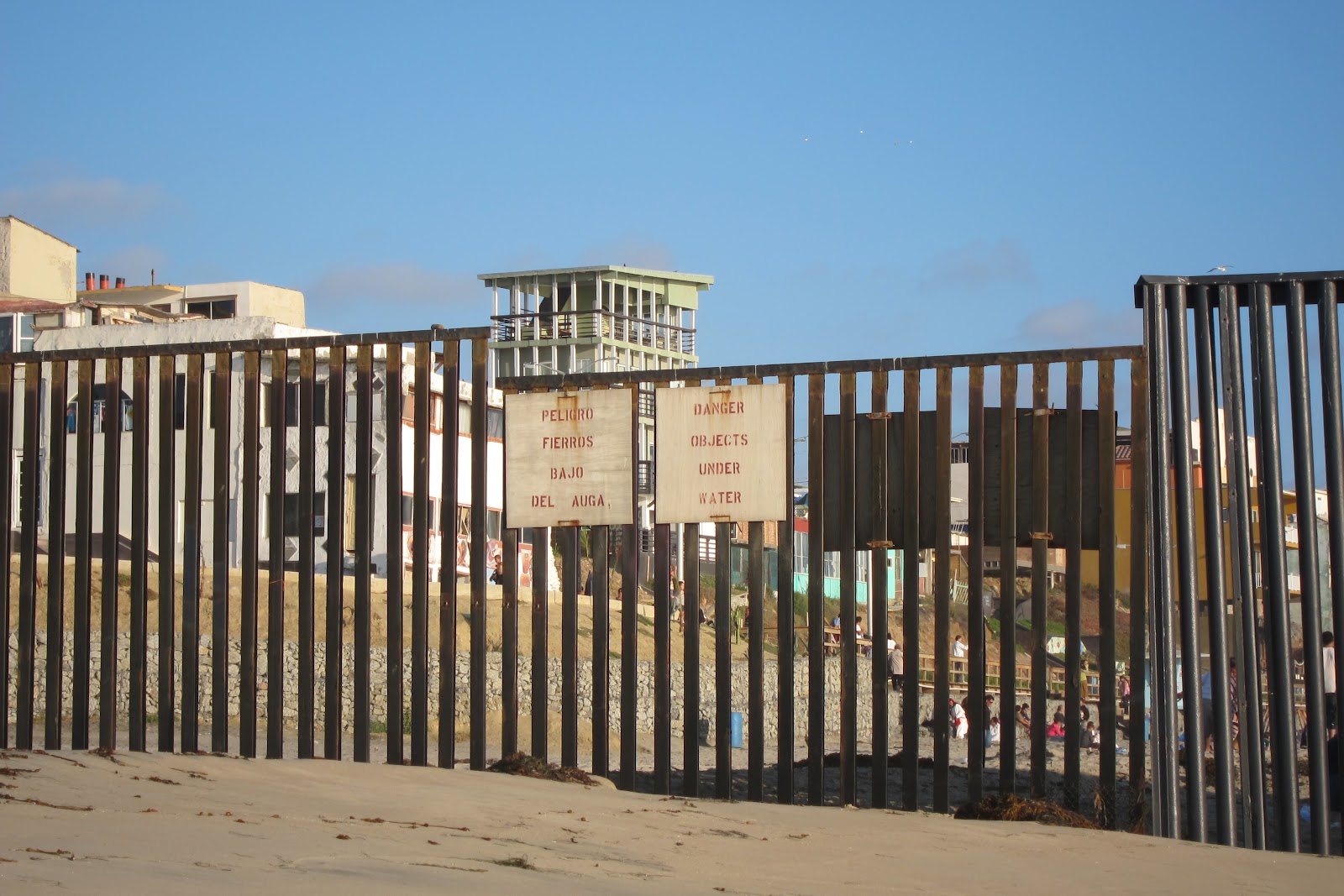
This entire time, we’d yet to encounter another person. The waves were drowning out the choppers at this point. It really was quite nice being able to walk along a beautiful beach like this one with no one in sight. The Coronado Islands were just on the horizon. And the wall was getting closer and closer. Soon, we were less than 100 feet away. We spotted one Border Patrol agent camped out in his jeep, and right around this time we noticed music coming from the south. 


Approaching the fence is a surreal experience. Our side was relatively desolate; we encountered a few people on horseback, but that was it. The Mexican side of the borderwas lively, with families playing on the beach, music booming, food being consumed, and people having a great time. It made me want to swim around the fence and join them!


It was getting late, so we decided to head back to the car. We didn’t get to see much, such as the Friendship Circle Monument or Smuggler’s Gulch (or any Mexicans trying to sneak across the border!), but what we saw was enough to warrant a visit for people curious to get a peak at this peculiar wall. Oh, and if you’re into bird watching, you’ll love it here.
            -J

One of the helicopters we saw.
Tijuana Estuary to the north
Reaching the ocean.
Tijuana in the distance.
Nicole and the fence.
Dramatic the way it goes into the ocean.
Everyone's living it up over there.
"Danger Objects Under Water"


Information:
Website: http://www.parks.ca.gov/?page_id=664
Fee: $5 on the weekends. During the week, gates are closed, but you can walk in gratis.

Two Fools in the Desert

No Comments »


Mud and wind caves.  Indian pictographs. Desert wildflowers.  Anza Borrego Desert California State Park offers approximately 1,000 square miles of caves, cliffs, and desert landscapes. It is the largest California state park and has much to offer if you don’t mind the extreme weather and have 4WD. Well, Jose and I are no desert rats and really didn’t understand the unpredictable weather or the vastness of space.   As a result, we didn’t get to see what we had originally planned. However, we did discover some hidden gems. This is a list of some lessons learned.
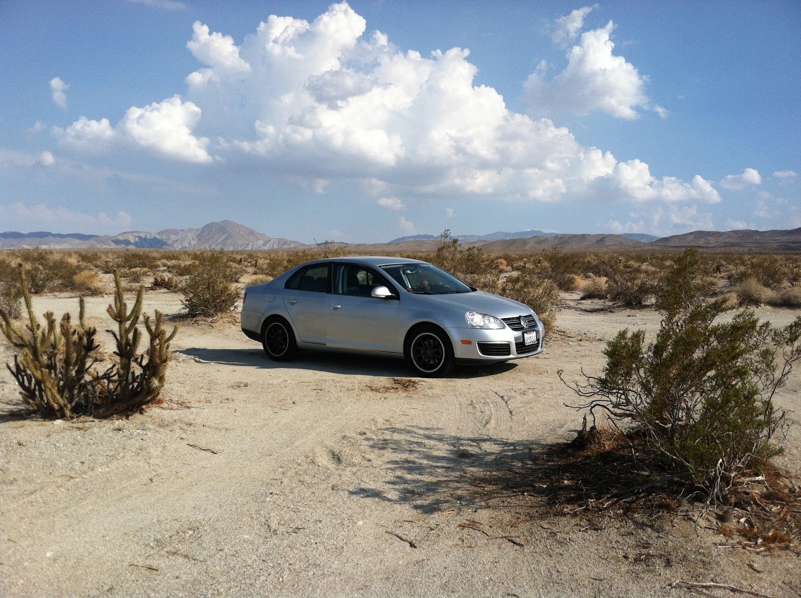
Bring the correct vehicle. Despite the fact that my silver VW Jetta looks great against the desert backdrop, my poor car was not made for desert trails. While many major roads and highways cross through Anza, some of the attractions are only accessible through “primitive roads.”
Check the weather. We were prepared for the heat. My car’s air conditioning was functioning. We purchased two gallons of water and nonperishable foods (Chip Ahoy Cookies) in case “something” happened. I even called my mother to tell her we were going and to expect to hear from us by 10 pm that night.
Apparently, deserts have thunder storms and flash flooding in summer. Upon visiting the visitor center to get directions to the mud caves, a park ranger told us that one park patron spent a few days trapped and was barely rescued earlier that day. So, we were unable to access the mud caves as well as the Indian pictographs- our primary reason for going to Anza Borrego.  Pretty devastating.
Bring a map. Anza Borrego’s signage is not very clear. Major roads are marked, however, the dirt roads in the desert are just as important but often unclear. We picked up a map at the visitor center; however, it isn’t always easy to decipher major desert roads from small turn-offs. Jose and I spent a good hour trying to get to one location driving my two-wheel drive onto dirt roads made for Jeep Wranglers.
                We did come across some amazing desert surprises. Artist Ricardo Breceda created an eerily beautiful sculpture garden which can be seen from Borrego Springs Rosd. As you head south from Borrego Springs, giant horses and dinosaurs made from scrap metal scatter the landscape.
                The Anza Borrego State Park Visitor Center is a pretty impressive facility, especially compared to other California State Parks. The air-conditioned building complements well with the backdrop. We even stopped to watch a short film, “A Year in the Desert,” and peruse the mini-museum.  
                After chatting with the park rangers in the visitor center, we received some recommendations on flood free sights. We settled on visiting an Indian archaeological site. Off of the 78 State Highway, a tiny sign led us to the dirt road called “Mine Wash.” This area is deemed “Kumeyaay Village” where California Indians made their home here seasonally. 
                Anza Borrego State Park is located within the Colorado Desert of Southern California. Bring a 4 Wheel Drive vehicle.
                -N

And we have arrived!

Me and the Giant Bird.

Infinite desert.
The visitor center. It has a bridge you can walk over. Disregard naked bike rider.

That just happened.

Jose's favorite dinosaur.
Clearing the trail of rocks.
Dark and sweaty.
Jose discovers mortars.
Indian Village. 

Checking out some rocks.


She looks good... like a car ad.
Good advice!


Information:
Anza-Borrego Desert State Park http://www.parks.ca.gov/?page_id=638
Ocotillo Wells State Vehicular Recreation Area http://ohv.parks.ca.gov/?page_id=1217
Information on Desert Sculptures http://www.galletameadows.com/